
Monsoon-Induced Landslides in Maharashtra: Causes, Challenges, and Mitigation Measures
Context
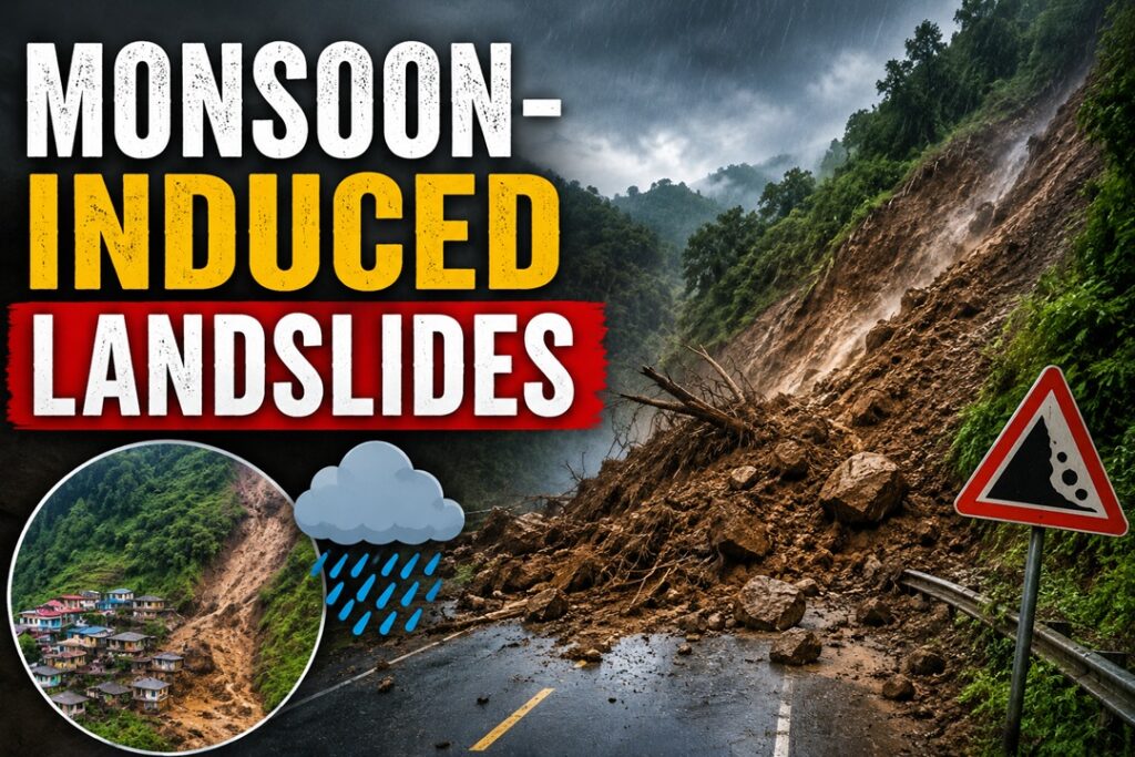
Persistent monsoon rains and successive slope failures battered parts of Maharashtra, disrupting transport by blocking the Mumbai–Pune Expressway and sections of the Mumbai–Goa National Highway.
Landslides
About Landslides
What are Landslides?
A landslide is the sudden downslope movement of rock, soil, debris, or earth material under the force of gravity. It occurs when the resisting strength of a slope is overcome by driving forces, leading to the collapse of unstable terrain.
Important Facts & Statistics
- Landslide-Susceptible Area: Nearly 15% of India’s geographical area (around 0.42 million sq km) is prone to landslides.
- High-Risk Regions: The Himalayan belt, North-Eastern states, Western Ghats, and Eastern Ghats are the most vulnerable due to fragile geology and steep slopes.
- Earthquake Link: Several landslide-prone regions lie within Seismic Zones IV and V, where earthquakes further weaken hill slopes.
Major Causes of Landslides in India
Heavy Monsoon Rainfall and Water Saturation
Continuous rainfall increases soil moisture, raises pore-water pressure, and weakens the stability of hill slopes.
Example: Intense monsoon showers in July 2026 saturated slopes near the Khopoli–Kusgaon corridor, resulting in rockfalls and traffic disruption.
Improper Excavation for Roads and Infrastructure
Unplanned cutting of hills for highways, tunnels, and railways without adequate slope protection disturbs natural stability.
Example: Expansion of transport infrastructure across the Konkan region has frequently triggered slope failures during monsoon months.
Loss of Forest Cover
Removal of vegetation reduces root binding, making soil more vulnerable to erosion and slope collapse.
Example: Large-scale clearing of trees around Mussoorie has increased the occurrence of landslides on steep terrain.
Geological and Seismic Instability
Young mountain ranges with fractured rock formations are naturally unstable and highly susceptible to landslides.
Example: The Himalayan region of Uttarakhand experiences recurring rockslides due to active tectonic movements.
Challenges in Landslide Disaster Management
Difficult Access to Affected Areas
Remote mountainous locations often delay rescue operations and emergency assistance.
Example: Rescue operations in Pune’s Mawal region required specialized NDRF equipment to reach isolated settlements.
Continuous Rain Affecting Relief Operations
Persistent rainfall increases the risk of secondary landslides and slows debris clearance.
Example: Restoration work along the Mumbai–Goa Highway faced repeated delays due to recurring rockfalls.
Weak Enforcement of Land-Use Regulations
Illegal construction and settlement on unstable hill slopes continue because of poor implementation of zoning laws.
Limited Localized Monitoring Systems
Many vulnerable regions lack advanced sensors capable of providing timely warnings before slope failures occur.
NDMA Guidelines for Landslide Management
The National Disaster Management Authority (NDMA) recommends both engineering and policy-based measures to reduce landslide risks.
Developing Comprehensive Landslide Databases
The Geological Survey of India (GSI) should maintain updated records of landslide events for scientific planning.
Hazard Zonation Mapping
Prepare detailed Landslide Hazard Zonation (LHZ) maps to identify high-risk areas and guide infrastructure development.
Slope Protection Measures
Adopt engineering solutions such as retaining walls, rock bolting, soil nailing, and wire-mesh protection to stabilize vulnerable slopes.
Efficient Drainage Systems
Improve surface and underground drainage to safely channel rainwater away from unstable hill slopes.
Way Forward
Establish Smart Early Warning Networks
Deploy IoT sensors, automated rain gauges, and ground movement detectors along vulnerable transport corridors for real-time alerts.
Install Protective Rockfall Structures
Construct rockfall barriers, catch fences, and protective galleries above highways passing through hilly terrain.
Expand Drone and LiDAR Surveys
Conduct regular drone-based and LiDAR mapping before every monsoon season to identify newly developed slope cracks.
Promote Scientific Hill Engineering
Ensure all hill-cutting and road projects follow scientific slope design, benching techniques, and geotechnical reinforcement standards.
Build Community Disaster Preparedness
Train local volunteers in landslide-prone villages on evacuation, first aid, communication, and emergency response.
Conclusion
Although agencies such as the Geological Survey of India (GSI) and the National Disaster Response Force (NDRF) play a crucial role in hazard assessment and emergency response, repeated landslide incidents underline the need for stronger planning and enforcement. Integrating scientific slope management, modern monitoring technologies, and strict land-use regulations will be essential to reducing future landslide risks and ensuring safer transport infrastructure.
Source : The Times Of India