
Flash Floods in the Himalayas: Causes, Risks and Disaster Preparedness
Context
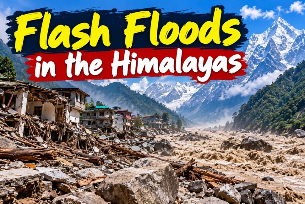
A sudden flash flood along Nepal’s Budhi Gandaki River in Gorkha district on October 11 swept away more than 35 houses and bridges, carrying large quantities of mud, boulders and debris. The absence of heavy rainfall suggested a possible breach of an upstream landslide dam or an avalanche-triggered blockage, highlighting the growing challenges of disaster management in the Himalayan region.
Understanding Flash Floods
Flash floods are sudden and rapid inundations that develop within a short period, generally within six hours of a triggering event. They are often associated with intense rainfall, cloudbursts, landslide-dam failures and glacial lake outburst floods (GLOFs).
Unlike conventional floods, flash floods in mountainous regions frequently carry enormous quantities of rocks, sediment and debris, making them highly destructive and leaving little time for evacuation.
Why Is the Himalayan Region Vulnerable?
– Geological Instability: The young, tectonically active Himalayas have steep slopes, fractured rocks and frequent seismic activity, increasing the likelihood of landslides and slope failures.
Example: The 2021 Chamoli disaster in Uttarakhand, where a rock-and-ice mass movement triggered destructive flooding in the Rishiganga-Dhauliganga valleys.
– Glacial Lake Instability: Rising temperatures accelerate glacier retreat and create or enlarge glacial lakes held back by fragile natural barriers. Their sudden breach can release enormous volumes of water.
Example: The 2023 South Lhonak glacial lake outburst in Sikkim caused severe flooding along the Teesta River and damaged the Chungthang hydropower dam.
– Cloudbursts and Extreme Rainfall: Moist monsoon winds rise over mountain slopes, producing intense, localized precipitation that rapidly overwhelms small river catchments.
Example: The 2013 Kedarnath disaster, which involved extreme rainfall, water and sediment surges, and widespread destruction.
– Unregulated Construction: Settlements, roads, bridges and hydropower projects built along active river channels and unstable slopes face heightened exposure to sudden floods and debris flows.
Example: Repeated flood damage to highways and commercial infrastructure in Himachal Pradesh’s Beas River valley.
Major Causes of Himalayan Flash Floods
– Landslide-Dam Failure: Landslides can temporarily block mountain streams, forming natural dams. When accumulated water breaches these barriers, a powerful flood wave moves downstream.
– Climate-Induced Slope Destabilisation: Warming temperatures melt glacier ice and thaw permafrost, weakening the natural bonds that hold rocks and sediments together.
– Mobilisation of Loose Sediments: Floodwaters pick up moraines, gravel and large boulders, transforming ordinary runoff into dense debris flows capable of destroying bridges and buildings.
– Extreme Hydro-Meteorological Events: Cloudbursts and intense rainfall can rapidly increase river discharge, especially in steep catchments with limited water-storage capacity.
– Avalanches and Rockfalls: Sudden mass movements may obstruct rivers or directly displace water, generating destructive surges even when local rainfall is limited.
Implications of Flash Floods
– Loss of Life and Displacement: Rapidly rising waters leave little time for warnings or evacuation, destroying homes and forcing communities to relocate.
– Damage to Critical Infrastructure: Bridges, roads, tunnels and hydropower facilities are vulnerable to high-velocity water and debris, disrupting connectivity and essential services.
– Disruption of Mountain Livelihoods: The destruction of agricultural terraces, livestock shelters, trails and suspension bridges affects farming, tourism and access to healthcare and education.
– Sedimentation and Downstream Flooding: Large deposits of rocks and sediment can raise riverbeds, reduce channel capacity and worsen flooding in downstream plains, including parts of Bihar.
– Transboundary Disaster Risks: Flood surges originating in Nepal or the Tibetan Plateau can travel into Indian river systems, leaving downstream communities with limited preparation time.
– Ecological Degradation: Debris deposition, erosion and damage to river habitats can disturb mountain ecosystems and alter natural drainage patterns.
NDMA Guidelines for Flash Flood Management
The National Disaster Management Authority (NDMA) emphasises risk assessment, monitoring, preparedness and coordinated response to reduce the impact of flash floods.
– Hazard Mapping: Identify vulnerable river valleys, unstable slopes and glacial lakes through updated flood-risk maps and remote-sensing technologies.
– Risk Reduction at Hazardous Lakes: Where technically feasible and environmentally safe, use controlled drainage, siphoning and other engineering interventions to reduce the risk of glacial or landslide-dam failures.
– Floodplain Regulation: Restrict construction in active river channels and high-risk floodways, and prevent unplanned expansion into vulnerable mountain valleys.
– Early Warning Systems: Combine weather radar, rainfall gauges, river-level sensors, satellite observations and communication networks to detect emerging threats and alert downstream populations.
– Community Preparedness: Develop evacuation plans, designate safe shelters and strengthen coordination among local authorities, disaster-response agencies and residents.
Way Forward
– Strengthen Regional Cooperation: India, Nepal and Bhutan should improve real-time sharing of rainfall, river-flow, landslide and glacial-lake data to facilitate timely cross-border warnings.
– Expand Ground-Based Monitoring: Install automated weather stations, river gauges and acoustic sensors in remote valleys, complementing satellite-based monitoring.
– Adopt Climate-Resilient Infrastructure: Make geological investigations, cumulative environmental assessments and disaster-risk evaluations essential for approving roads, bridges, tunnels and hydropower projects.
– Improve Community-Level Response: Train local volunteers under initiatives such as Aapda Mitra, establish evacuation routes and ensure emergency communication facilities in isolated settlements.
– Integrate Climate and Geological Risk Planning: Regularly update hazard assessments to account for glacier retreat, changing precipitation patterns, permafrost degradation and shifting river channels.
– Promote Scientific Land-Use Planning: Protect natural drainage systems, restore degraded slopes where appropriate and avoid development in areas exposed to recurring debris flows.
Conclusion
The flash flood along Nepal’s Budhi Gandaki River highlights the complex interaction between geological instability, climate change and human exposure in the Himalayas. Since such disasters can occur even without intense local rainfall, disaster management must move beyond rainfall-based forecasting towards integrated geological monitoring, effective early warnings and regional cooperation. A preventive, science-based and community-centred approach is essential to protect Himalayan lives, livelihoods and critical infrastructure.
Source : The Indian Express