
Nepal Flash Floods: Himalayan Hazards, Transboundary Risks and Disaster Preparedness
Context
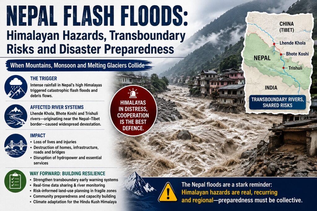
A catastrophic flash flood and debris-flow disaster struck the Nepal–Tibet border region on August 26, 2026, severely affecting the Lhende Khola, Bhote Koshi and Trishuli river systems. The event demonstrated how glacier instability, steep Himalayan terrain and interconnected river systems can combine to create sudden, transboundary disasters.
Understanding the Nepal Flash Flood Disaster
What Happened?
- A flash flood is a sudden and rapid rise in river discharge, often caused by intense rainfall, dam failure, landslides, glacier collapse or glacial lake outburst floods.
- In this case, initial reports suspected that an earthquake-triggered ice-rock avalanche had caused the disaster.
- Subsequent assessments indicated that the seismic signal was generated by a large glacier/ice-rock collapse itself, rather than an earthquake triggering it.
- A huge mass of ice, rock and sediment entered the Lhende Khola, generating a powerful debris-laden surge.
- The flood then travelled through the interconnected Bhote Koshi–Trishuli system, causing extensive destruction downstream.
Major Facts and Figures
- Severe Human Loss: Initial reports recorded at least 160 deaths, with hundreds of people missing.
- Indian Nationals Affected: A significant number of Indians, including workers and pilgrims travelling towards the Kailash-Mansarovar region, were among those reported missing.
- Rapid River Rise: The Trishuli River rose by around 9 metres within 30 minutes, demonstrating the extraordinary speed of the flood surge.
- Infrastructure Destruction: Roads, bridges, houses, communication links and power infrastructure were badly damaged.
- Gyirong Port Disrupted: Mud and debris reached Gyirong Port, an important Nepal–Tibet trade and transit point, disrupting transportation and communication links.
- Hydropower Vulnerability: The destruction of infrastructure along Himalayan rivers has highlighted the vulnerability of Nepal’s rapidly expanding hydropower sector to extreme floods and debris flows.
Why Is Nepal Highly Vulnerable to Himalayan Disasters?
1. Steep Mountain Relief
- Nepal contains some of the world’s highest mountains alongside extremely narrow and deep river valleys.
- Steep gradients accelerate water flow and give floods enormous destructive energy.
- Narrow valleys effectively act as natural funnels, concentrating floodwater, rocks and debris.
2. Active Tectonic Setting
- Nepal lies along the collision zone between the Indian and Eurasian tectonic plates.
- Earthquakes can destabilise already fragile mountain slopes and glaciers.
- The latest disaster also highlights the importance of distinguishing between earthquake-triggered events and seismic signals generated by glacier or landslide collapses.
3. Rapid Cryospheric Change
- Rising temperatures are accelerating glacier retreat, snowmelt and permafrost degradation across the Himalayas.
- These processes can weaken mountain slopes and increase the likelihood of rockfalls, ice avalanches and other cascading hazards.
- A warming climate can therefore amplify the vulnerability of high-altitude regions to multiple interacting hazards.
4. High Sediment Availability
- Himalayan rivers carry large quantities of rocks, boulders, gravel and glacial sediment.
- When extreme flows mobilise this material, a normal flood can become a highly destructive debris flow.
- The resulting mixture is considerably more damaging to bridges, roads, hydropower facilities and settlements than water alone.
5. Concentrated Human Settlements
- Flat and habitable land is limited in mountainous Nepal.
- Communities, roads, bridges, hydropower projects and worker camps are therefore often concentrated along river valleys.
- A single disaster can simultaneously destroy transportation routes and isolate entire communities, complicating rescue operations.
Chain of Events Behind the Disaster
Glacier/Ice-Rock Collapse → Ice and Rock Avalanche → Lhende Khola Surge → Bhote Koshi → Trishuli River → Rapid Downstream Flooding and Debris Flow
- Glacial/Rock Instability: A large section of high-altitude ice and rock collapsed in the Himalayan border region.
- Avalanche: The falling mass accumulated enormous quantities of rock, ice and sediment.
- River Impact: The material entered the Lhende Khola and dramatically increased the volume and destructive force of the river flow.
- Debris-Laden Surge: The resulting mixture of water, mud, ice and boulders moved rapidly downstream.
- River Amplification: The surge entered the Bhote Koshi and subsequently the Trishuli system.
- Downstream Destruction: Settlements, roads, bridges, hydropower infrastructure and other facilities were overwhelmed.
Consequences for India and the Wider Himalayan Region
1. Transboundary Flood Risk
The disaster illustrates that Himalayan hazards do not stop at political boundaries.
- The Lhende Khola feeds the Bhote Koshi, which connects with the Trishuli system.
- The Trishuli eventually joins the Narayani River.
- The Narayani enters India and is known as the Gandak, flowing through the northern plains, including Bihar.
- Consequently, sudden changes in Himalayan river discharge can create downstream risks for Indian communities.
2. Safety of Indian Citizens
- Indian workers, engineers, tourists and pilgrims frequently travel through Himalayan border regions.
- Many are associated with hydropower, infrastructure, construction and pilgrimage activities.
- The large number of Indians among those reported missing highlights the importance of cross-border emergency coordination and citizen-tracking mechanisms.
3. Hydropower Vulnerability
- Nepal’s mountainous rivers provide enormous potential for hydropower generation.
- However, projects located along narrow river valleys face risks from:
- Flash floods
- GLOFs
- Landslides
- Debris flows
- Rock and ice avalanches
- Damage to hydropower facilities can affect both Nepal’s domestic electricity supply and its electricity trade with India.
4. Trade and Connectivity Disruption
- The destruction of roads and bridges can isolate mountain communities and disrupt regional trade.
- Damage to Gyirong Port demonstrates how a natural disaster can affect not only local populations but also international transportation and supply chains.
5. Humanitarian and Diplomatic Dimension
The disaster reinforces the importance of Humanitarian Assistance and Disaster Relief (HADR) cooperation among India, Nepal and China.
Cross-border cooperation is particularly important when:
- Rivers cross international boundaries.
- Foreign nationals are among the victims.
- Roads and airports are damaged.
- Rescue teams require access to neighbouring territories.
- Early warnings need to reach downstream populations rapidly.
Key Measures for Disaster Risk Reduction
1. Strengthen Mountain Early-Warning Systems
- Install dense networks of:
- Automatic river gauges
- Seismic sensors
- Glacier monitoring stations
- Weather radars
- Satellite-based observation systems
- Develop warning mechanisms capable of detecting sudden changes in river levels and glacier stability.
2. Improve Cross-Border Data Sharing
India, Nepal and China should strengthen real-time exchange of information on:
- River discharge
- Extreme rainfall
- Glacier movement
- Glacial lakes
- Landslide dams
- Sudden river-level changes
- Seismic and geomorphological disturbances
The objective should be to convert data sharing into actionable early warnings for downstream communities.
3. Make Hydropower Infrastructure Climate-Resilient
Future projects should incorporate:
- Higher flood-design standards
- Greater freeboard
- Debris-flow protection
- Stronger diversion structures
- Sediment management
- Safer locations for critical equipment
- Emergency shutdown mechanisms
Existing projects should also undergo climate and multi-hazard risk assessments.
4. Regulate Construction in High-Risk Zones
- Avoid locating settlements, worker camps, roads and critical infrastructure directly on vulnerable riverbanks and floodplains.
- Prepare detailed hazard zonation maps before approving new infrastructure.
- Incorporate glacier, landslide and debris-flow risks into land-use planning.
5. Establish Specialised Mountain Response Units
Dedicated Himalayan disaster-response teams should be equipped with:
- Helicopters
- Drones
- Satellite communication
- Search-and-rescue equipment
- Portable river-monitoring systems
- Heavy debris-clearing machinery
This would reduce dependence on road access, which is often the first infrastructure to fail during mountain disasters.
6. Strengthen Community-Level Preparedness
Local communities should receive:
- Evacuation training
- Clearly marked evacuation routes
- Community shelters
- Emergency communication systems
- Regular mock drills
- Local disaster-response volunteers
Last-mile warning dissemination is especially important because even a few minutes of warning can save lives during a sudden flood.
Way Forward
The disaster calls for a shift from a reactive relief-oriented approach to anticipatory disaster-risk management.
India, Nepal and China should develop a stronger Himalayan multi-hazard monitoring and response framework covering glaciers, landslides, earthquakes, extreme rainfall and river floods. Infrastructure planning should also adopt a cumulative-risk approach, rather than assessing individual projects in isolation.
Conclusion
The Nepal flash floods highlight the cascading and transboundary nature of Himalayan disasters. Strengthening early-warning systems, cross-border data sharing, resilient infrastructure and coordinated disaster response is essential to protect vulnerable Himalayan communities and downstream regions.
Source : The Indian Express