
Coastal Erosion in Odisha: Rising Shoreline Vulnerability and India’s Response
Context
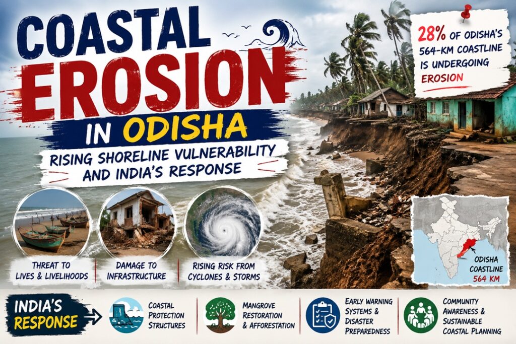
The Union Minister for Ports, Shipping and Waterways recently informed the Rajya Sabha that nearly 28% of Odisha’s 564-km coastline is affected by coastal erosion.
Understanding Coastal Erosion
- Meaning – Coastal erosion refers to the gradual removal of land, beaches, sand dunes and coastal rocks due to marine and atmospheric forces.
- It occurs when waves, tides, currents and winds transport coastal sediments away faster than they are naturally replenished.
Major Drivers
- Wave Energy – Strong waves continuously strike the shoreline and remove sediments and weather rocks.
- Cyclones and Storm Surges – High winds, powerful waves and storm surges accelerate shoreline retreat.
- Sea-Level Rise – Rising sea levels allow waves to penetrate further inland, increasing erosion.
- Degradation of Mangroves – Loss of mangrove cover removes an important natural barrier against waves and storm surges.
- Anthropogenic Activities – Ports, sand mining, coastal construction and poorly planned hard structures can disturb natural sediment movement.
Processes Involved
- Hydraulic Action – Water and compressed air enter cracks in rocks, gradually weakening them.
- Abrasion – Sand and rock fragments carried by waves scrape and wear down coastal surfaces.
- Attrition – Sediments collide with one another and become smaller and smoother.
- Solution – Slightly acidic seawater chemically dissolves susceptible rocks and minerals.
India’s Coastal Erosion Scenario
- Around 33.6% of India’s 7,516-km coastline is vulnerable to coastal erosion.
- According to assessments by the National Centre for Coastal Research (NCCR), several coastal States face significant shoreline retreat because of sea-level rise, cyclones, wave action and human interventions.
States Facing Significant Shoreline Loss
- West Bengal – Nearly 60.5% of its coastline is affected by erosion.
- Kerala – Around 46.4% of the shoreline is vulnerable to erosion and associated flooding.
- Tamil Nadu – Approximately 42.7% of its coast experiences erosion.
- Gujarat – Has the largest absolute length of eroding shoreline, exceeding 537 km.
- Odisha – More than 28% of its coastline is undergoing erosion.
Consequences of Shoreline Retreat
- Coastal Land Loss – Beaches, agricultural areas and settlements may gradually disappear.
- Infrastructure Damage – Roads, railways, houses, ports, tourism facilities and other assets face increased risks.
- Population Displacement – Repeated erosion can force coastal communities to relocate.
- Livelihood Disruption – Fishing, farming, tourism and other coastal economic activities may suffer.
- Salinity Intrusion – Seawater entering groundwater and agricultural land can reduce freshwater availability and crop productivity.
- Ecological Degradation – Mangroves, dunes, wetlands, coral ecosystems and nesting habitats can be damaged.
- Greater Disaster Risk – Erosion weakens natural coastal buffers, increasing vulnerability to cyclones, flooding and storm surges.
- Financial Burden – Governments face rising expenditure on coastal defence, rehabilitation and resettlement.
- Threat to Heritage – Coastal temples, archaeological remains and culturally important settlements may be endangered.
- Tourism Impact – Shrinking beaches can reduce the attractiveness and economic value of coastal destinations.
India’s Strategy to Manage Coastal Erosion
- Coastal Surveillance and Assessment – The National Centre for Coastal Research (NCCR) employs satellite data, GIS, field observations and modelling to track shoreline changes.
- CRZ Framework – The Coastal Regulation Zone (CRZ) Notification, 2019 regulates development along coastal stretches and seeks to protect sensitive ecosystems.
- Shoreline Management Plans – NCCR has prepared Shoreline Management Plans (SMPs) for States including Kerala, Tamil Nadu, Andhra Pradesh and Puducherry.
- Engineering and Ecological Interventions – Depending on local conditions, authorities employ seawalls, groynes, submerged structures, beach nourishment, artificial reefs and dune restoration.
- Financial and Disaster-Management Support – Guidelines under the National Disaster Management Fund (NDMF) provide support for mitigating coastal and river erosion, including provisions for affected populations.
Odisha: A Coastal Erosion Hotspot
- Extent of Erosion – NCCR’s 1990–2022 assessment indicates that around 28.3% of Odisha’s 564-km coastline is eroding, while 17.6% remains stable and 54.1% is witnessing accretion.
- Underlying Factors – Waves, tides, cyclones, storms, sea-level rise and human interventions such as port development, sand extraction and unplanned construction contribute to shoreline changes.
Districts with Higher Erosion
- Jagatsinghpur – About 47.6%
- Ganjam – About 45.7%
- Kendrapara – About 45%
- Balasore – About 23.8%
- Puri – About 10.2%
- Bhadrak – About 4.6%
Critical Coastal Stretches
- Erosion-prone locations identified by NCCR include Gopalpur, Pentha–Satbhaya, Gahirmatha, the Jagatsinghpur coast, Chilika sea mouth, Devi river mouth and Talsari.
- Persistent shoreline retreat threatens habitations, livelihoods, infrastructure and coastal ecosystems, highlighting the need for integrated coastal-zone planning.
- Kendrapara has witnessed severe climate-linked erosion and sea-level rise, with several villages reportedly submerged or affected, resulting in displacement and loss of livelihoods.
- In Ganjam, settlements including Podampeta and Ramayapatna have experienced substantial shoreline retreat, forcing residents to move from vulnerable areas.
Odisha’s Key Interventions
- Resettlement Support – Odisha has developed a dedicated resettlement colony for people displaced by coastal erosion.
- Geotextile Tube Protection – At Pentha in Kendrapara, sand-filled geotextile tubes function as artificial barriers to reduce wave energy and shoreline damage.
- Sea Walls with Service Roads – Multi-purpose structures are being developed at vulnerable locations in Balasore and Ganjam, combining erosion control with road connectivity.
Way Forward
- Evidence-Based Coastal Planning – Regular satellite observation, GIS-based mapping and updated Shoreline Management Plans should guide interventions.
- Expand Nature-Based Approaches – Mangrove restoration, dune conservation, wetland protection and beach nourishment should complement hard engineering structures.
- Build Resilient Coastal Communities – Early-warning systems, disaster-resilient infrastructure, livelihood protection and planned relocation should be strengthened in high-risk areas.
- Adopt Integrated Coastal Management – Effective coordination among the Centre, State governments, local communities and scientific institutions is essential for sustainable shoreline protection.
- Prioritise Local Solutions – Coastal protection measures should be based on site-specific geomorphology, sediment movement and ecological conditions rather than relying on a uniform engineering approach.
Source : PIB